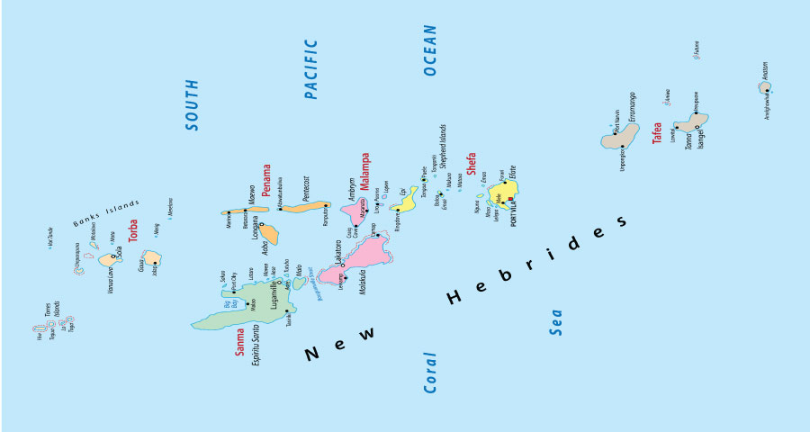
Vanuatu is an island country that has been divided into six provinces since 1994, Here is the complete list of all provinces including the deep details of their capital, Islands, Arial Distance, and Current Population.

List of Provinces of Vanuatu
| Province Name | Capital | Iceland | Areal Distance | Populations |
| Malampa | Lakatoro | Ambrym, Malakula, Paama | 2,779 Km2 | 40,928 |
| Torba | Sola | Banks and Torres Islands | 882 Km2 | 10,161 |
| Shefa | Port Vila | Efate, Shepherd Islands, Epi | 1,455 Km2 | 97,602 |
| Penama | Pentecost | Pentecost Island, Ambae, Maéwo | 1,198 Km2 | 32,543 |
| Sanma | Luganville | Santo, Malo | 4,248 Km2 | 54,184 |
| Tafea | Isangel | Tanna, Aniwa, Futuna, Erromango, Anatom | 1,628 Km2 | 37,050 |
Let’s Discuss About Municipalities
First "What is Municipalities?" "Why we are discussing Municipalities?"; here we are going to discuss Municipalities because some provinces are divided into municipalities headed by a council and a mayor elected from among the members of the council; for more understanding read carefully the below-mentioned list:
Total Municipalities of Tafea Province
Tafea Province is a province of Vanuatu but it is divided into multiple Municipalities such as:
- North Erromango
- South Erromango
- North Tanna
- West Tanna
- Middle Bush Tanna
- Whitesands
- South West Tanna
- South Tanna